A new adventure begins!
For Sara and Laura's LAST spring break, we decided to visit the Grand
Canyon. And we will, but not until the end of the week.
Our Arizona adventure began
yesterday, when Laura and Sara flew to Phoenix from Oakland and I joined them
from LA, and the three of us flew together to Flagstaff. We picked up our
rental car at the airport and set out to take care of the girls' top priority:
Mexican food! The consensus at the rental car desk, among clerks AND
customers, was that we should go to La Fonda. It was delicious and the
plates were huge. We gave up trying to finish about halfway through our
meals, but we did find room for the fresh sopapillas and honey that arrived at
the end of our meal.
Stuffed, we set out on
Route 66 (THE Route 66) and then Route 89 to Page, up near the Utah border.
By the time we reached Page, it was after dark. We checked into our
hotel and relaxed, plus I visited Walmart across the street and stocked up on
sunscreen and groceries for our week.
Today's primary focus was
Antelope Canyon - both Upper and Lower. We toured the Upper Antelope
Canyon in the morning. Our Navajo guide, Nate, told us about the region,
pointed out landmarks and explained what we would see, all before we even
reached the canyon. When we entered the canyon, it was every bit as
spectacular as all the pictures. Each turn yielded another amazing view
of the sculpted sandstone walls, carved over 1.8 billion years by water and
wind. The shapes and the light draw loads of serious photographers and
sightseers. We wandered through the narrow canyon passages with Nate
pointing out for us different shapes and the best points from which to take
pictures. He even took pictures for and of us!
After our tour, we had a
couple hours until we planned to tour Lower Antelope Canyon. We decided
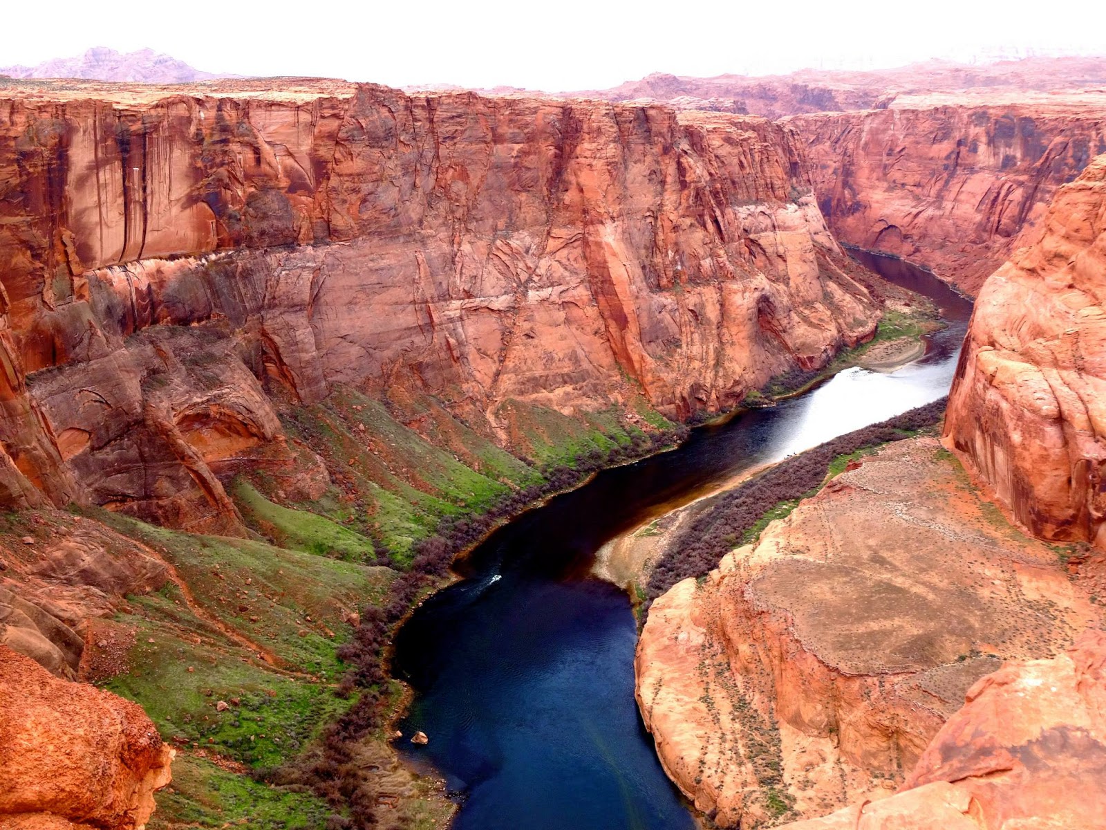
to take our sandwich lunch to Horseshoe Bend, a spectacular meander in the
Colorado River that has cut deep into the earth. We hiked a short way
over sand, rocks and scrub to the edge of the cliff - or at least as close as
we dared. The 1,000 foot drop-off is completely unprotected, with
weathered sandstone ledges jutting out over the river. We were awed and
terrified. We took pictures and then sat on a rock, eating our lunch.
However, it was not a relaxed picnic. Watching other tourists
jumping around near the edge, posing for photos, was very stressful. I
was just glad that I didn't have any little kids to keep track of.
Our tour of Lower Antelope
Canyon was, if anything, even more spectacular that Upper Antelope Canyon.
The Lower canyon is deeper and more of a V shape. To access it, you
have to climb down a series of steel steps to the canyon floor. It was
also less crowded, which made it seem like we had more time to work our way
through. Kordel, our Navajo guide for this tour, was excellent. He
showed us settings for our cameras that we didn't know we had that gave us
terrific photos. He too pointed out shapes of animals and people that
were easy to recognize in the sculpted sandstone walls and took some pictures
for and of us.
To finish our sightseeing
for the day, we set out late in the afternoon for the Glen Canyon Dam overlook,
from where, you guessed it, you get a great view of the Glen Canyon Dam.
We took some pictures and then continued on across the bridge next to the
dam to Wahweap Overlook. From this elevated plateau, we had 360 degree
views of Lake Powell, the Vermillion Cliffs and countless magnificent
geological features. It was a lovely place to wind up our day.
Having not satisfied Laura
and Sara's craving for Mexican food (it can't be satisfied), we had another
great Mexican meal, this time at Fiesta Mexicana in Page. We are now near
food coma state, relaxing in our hotel room. Tomorrow, Monument Valley!

Upper Antelope Canyon


Horseshoe Bend


Glen Canyon Dam


Wahweap Overlook


No comments:
Post a Comment